
Jul 28, 2026
Off-Grid Mapping in the UK: Local PPK in DJI Terra with the D-RTK 3 Base Station
Network RTK correction services like Ntrip are completely useless across roughly thirty percent of the UK landmass. If you are tasking an enterprise platform across the Scottish Highlands, the Welsh valleys, or the upper reaches of the Pennines, relying on a 4G SIM card inside your remote controller is an operational gamble that will leave you grounded. Real-Time Kinematic positioning falls apart the second cellular telemetry drops out, forcing serious survey teams to fall back on Post-Processed Kinematic (PPK) workflows to guarantee centimetre-level positional accuracy.
The Physical Reality of Off-Grid Data Acquisition
High-precision aerial surveying without network coverage requires a self-contained local positioning setup. Running a high-altitude mapping route over remote terrain without a reliable cellular connection means the aircraft must record raw satellite observation data directly to its internal storage alongside IMU trajectory logs.
The DJI D-RTK 3 Multifunctional Station operates as an independent, high-precision GNSS base receiver, capturing triple-band satellite data independently of external internet connections. By logging local observation files over a static known point or an arbitrary local benchmark, the station creates the baseline required for post-flight trajectory corrections.
Cold mountain winds and sub-zero temperatures rapidly deplete ground station batteries, making power management as important as satellite geometry. Leaning over a frozen van tailgate with numb fingers trying to verify GNSS satellite constellation locks is where field operations actually succeed or fail.
Local PPK Computation Inside DJI Terra
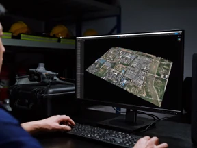
Processing raw RINEX observation data locally eliminates the need for cloud-based photogrammetry subscriptions. DJI Terra features a built-in PPK engine that directly ingests the raw observation files from the aircraft alongside the static satellite data recorded by the D-RTK 3.
The local software calculates the precise baseline between the mobile aircraft and the stationary base, adjusting timestamped image positions down to sub-centimetre accuracy before 3D reconstruction begins.
-
Satellite Constellation Access: Simultaneous tracking across GPS, Galileo, BeiDou and GLONASS ensures optimal satellite availability even in deep valley topography where horizon masking occurs.
-
Timestamp Synchronization: Microsecond-level hardware TimeSync aligns camera shutter triggers directly with GNSS positional logs, removing tilt errors and rotational velocity displacement.
-
Offline Processing Independence: Complete reconstruction occurs on local workstations without transferring gigabytes of raw TIFF or point cloud files over sluggish mobile networks.
Raw manufacturer claims of 45-minute flight times rarely reflect reality when flying against severe Atlantic headwinds on exposed moorland. High wind resistance demands higher motor output, reducing practical operational windows down to 30 minutes before reaching low-battery Return to Home thresholds.
Eliminating the Offline Compliance Nightmare
Paperwork obligations do not disappear just because you have stepped outside mobile network coverage. Operating under a Civil Aviation Authority Operational Authorisation demands that comprehensive site risk assessments, airspace checks, and pilot competency records are established before spinning up motors.
Planning operations in advance inside Dronedesk allows survey teams to create Ordnance Survey mapping data, local NOTAMs, and emergency contact registries. Completing pre-flight risk checks, site boundary definitions, and CAA-compliant RAMS prior to leaving mobile coverage ensures your audit trail remains unbroken when operating in blackspots.
Reconciling flight logs after a grueling week on-site creates a massive administrative hangover if managed manually through spreadsheets. Modern fleet management platforms let you import raw flight records directly from the controller once reconnected to local Wi-Fi, automatically updating pilot currency records, motor maintenance logs, and battery charge cycle metrics.
Ready to upgrade your remote surveying toolkit? Explore enterprise hardware options at Dronedesk Shop and streamline your operational compliance using Dronedesk software.