
Aug 3, 2026
High-Precision Surveying Guide: Master Smart 3D Capture with the Matrice 4E
The Reality of Structural Photogrammetry in UK Airspace
Flying a close-range photogrammetry mission over a Victorian brick viaduct or a modern glass-clad commercial build in the UK usually means choosing between two compromises. You either fly manual orbits at a terrifyingly close distance while keeping one eye on the anemometer, or you set up rigid grid routes that miss deep recesses and overhangs.
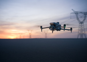
Under CAA rules, maintaining line of sight while managing lateral separation from uninvolved people requires tight spatial control. The Matrice 4E addresses this exact structural surveying problem by pairing hardware precision with onboard processing.
Equipped with a 4/3 CMOS 20MP mechanical shutter wide-angle camera, the Matrice 4E captures images at a rapid 0.5-second interval without rolling shutter distortion. This shutter speed lets you fly survey lines at up to 21 metres per second while keeping point cloud data sharp. When capturing complex vertical assets, traditional top-down grid flights simply leave huge data holes in facades and beneath eaves.
Smart 3D Capture changes this field workflow entirely. Instead of spending hours drawing complex 3D waypoint paths on a laptop before setting foot on site, the remote controller handles the processing directly in the field.
Hardware Fundamentals: What Makes the Matrice 4E a Survey Asset
Mechanical shutter performance eliminates the blur that ruins high-speed orthomosaics. The 20MP 4/3 CMOS sensor operates with a mechanical shutter speed up to 1/2000th of a second. This mechanical shutter ensures that every pixel remains crisp even during high-velocity mapping passes across changing elevations.
Camera triggering frequency drops to 0.5 seconds on the Matrice 4E. This faster trigger interval allows higher ground speeds while maintaining the 80% frontal overlap required for sub-centimetre model reconstruction. You cover significantly more square metres per battery set without sacrificing spatial density.
Complementing the primary mapping lens are the medium telephoto and telephoto sensors paired with an integrated laser rangefinder. The laser rangefinder measures surface distances up to 3000 metres in real time, projecting spatial coordinates directly onto the Pilot 2 screen. This capability lets you quickly tag asset features or verify ground clearances before executing automated routines.
Step 1: Executing the Initial Reconnaissance Flight
Generating an accurate close-range 3D model starts with capturing a quick, high-level survey pass. You do not need to fly close to the structure during this first step. Keep the aircraft well above surrounding hazards, trees, and site infrastructure at a safe, uniform altitude.
Set up a standard Area Route in DJI Pilot 2 over the target asset. Enable Smart Oblique mode with a standard 70% side overlap and 80% frontal overlap. The Matrice 4E uses three-directional ortho capture during this pass, tilting its gimbal left and right to gather oblique context alongside nadir frames.
This initial flight takes roughly five to eight minutes for a typical commercial building. As the aircraft completes the grid, the image files save directly to the internal storage while the controller builds a local mapping project. You land the aircraft with a complete set of preliminary images ready for processing.
Step 2: Processing On-Controller Point Clouds with RC Plus 2
You do not need an internet connection or a portable workstation to build your initial structural model. The RC Plus 2 Enterprise remote controller runs a lightweight processing engine capable of rendering point clouds on site. This process takes advantage of the onboard computing hardware to process up to 400 photos directly from the flight.
Open the Smart 3D Capture tool on the controller screen once the reconnaissance flight lands. Select the photo set from the initial pass and initiate the local mapping routine. Within three to five minutes, a three-dimensional point cloud of the building appears on your screen.
This point cloud is not your final client deliverable. It serves as an accurate spatial framework of the site structure and surrounding obstacles. You can rotate, zoom, and inspect the structural geometry right there on the tailgate of your van.
Step 3: Defining the Automated Close-Range 3D Route
With the rough point cloud rendered on screen, you draw a targeted polygon around the structure. Tap the display screen to set boundary points around the specific facade, roofline, or complex architectural feature you need to map.
Set your target standoff distance from the building surface. The Matrice 4E allows automated route planning as close as one metre to the asset face, yielding ground sampling distances down to 0.3 millimetres. For standard structural inspections, a standoff distance of three to five metres offers an ideal balance of coverage and safety.
The software automatically generates a three-dimensional, multi-axis flight path wrapping around the building geometry. The gimbal continually adjusts its tilt and pan to maintain perpendicular alignment with the structural surfaces. This eliminates the uneven coverage common with manual spiral flights or flat slope routes.
Before launching, turn on the AR Flight Preview feature. This Augmented Reality overlay projects the generated 3D flight path directly onto your live FPV and camera feeds. You can visually verify that the route maintains clear separation from scaffolding, cranes, or nearby treelines before starting the motors.
Operational Safety and Containment Under UK SORA
Flying close-range inspection routes near complex structures brings strict compliance requirements. When operating a 2.7 kg platform like the Matrice 4E near buildings, managing your Ground Risk Buffer (GRB) and Contingency Volume is essential.
The Matrice 4E features six omnidirectional low-light fisheye vision sensors paired with a bottom-mounted millimetre-wave radar. This multi-sensor array maintains active obstacle avoidance even in low-contrast environments or beneath shadowed bridge decks. Set your obstacle behavior to Avoid rather than Brake to allow smooth path corrections during automated 3D passes.
If you operate under a UK SORA Operational Authorisation, calculating your precise population density metrics around the site is mandatory. Dronedesk automates the JARUS SORA 2.5 kernel density calculations, evaluating local GHS-POP data across your exact flight geography, contingency volume, and ground risk buffer.
When mapping urban structures, controlled ground areas must be clearly marked. Ensure that your site boundary accounts for the 1:1 rule or ballistic fallback distances dictated by your declared operational ceiling. Having these calculations pre-formatted in your flight pack protects your operator standard during CAA audits.
Step 4: Data Offboarding and High-Precision Processing in DJI Terra
Once the close-range capture completes, pull the storage media and transfer the raw data to your processing suite. The Matrice 4E writes camera calibration parameters directly into the XMP metadata of every JPEG and DNG file. This factory calibration feeds straight into alignment algorithms without requiring manual lens profile adjustments.
Import the image dataset into DJI Terra for 3D reconstruction. Select High Precision mode and assign your local coordinate reference system, such as OSGB36 for UK projects. Because the Matrice 4E captures synchronized RTK positioning timestamps, image alignment aligns tightly to known ground control points.
Processing the combined datasets—the high-level oblique grid and the close-range 3D capture—yields a dense point cloud and textured mesh. The resulting model captures fine details like mortar deterioration, hairline concrete cracking, and bolt corrosion that standard aerial mapping misses.
For client delivery, export the processed files into standard formats like OBJ, LAS, or 3D Tiles. You can run semantic classification in software tools to automatically separate ground, vegetation, and structural elements. This clean separation simplifies building information model generation for your structural engineering clients.
Streamlining Survey Administration with Dronedesk
High-precision hardware only solves half of the commercial enterprise equation. Spending three hours on risk assessments, landowner permissions, and battery tracking for a thirty-minute flight destroys the profitability of small-crew survey operations.
Dronedesk bridges the gap between field data collection and business administration. The platform consolidates flight logging, fleet management, and site hazard checks into a single cloud dashboard.
When you plan a survey site, Dronedesk automatically pulls local Air Traffic Control contacts, Flight Restriction Zones, weather forecasts, and satellite hazard layers. It enables you to add comprehensive, CAA-compliant Risk Assessment and Method Statement documents to your records with a few clicks. You arrive on site with full regulatory backing and clear operational records.
Battery health tracking is built into the workflow. Log every charge cycle and internal resistance reading for your Matrice 4E battery sets to maintain complete equipment audit trails. This continuous logging ensures equipment reliability when operating in demanding UK weather conditions.
Scaling a commercial drone business requires combining efficient field hardware with automated back-office management. Upgrade your enterprise mapping capabilities with the Matrice 4E from Dronedesk Shop. , and back your operations with Dronedesk workflow software to keep your fleet compliant, efficient, and profitable.